South Austin Area Neighborhoods
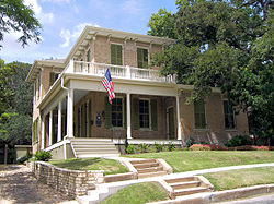
South Austin
South Austin generally includes any area south of the Colorado River.
Barton Springs Pool in Zilker

South Congress
Apartments in East Riverside
Barton Creek
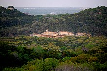
Lady Bird Johnson Wildflower Center in Circle C
South Central
South Central Austin is boxed by Mopac Expressway to the west, the Colorado River to the north, Interstate 35 to the east, and Ben White Boulevard to the south.
Barton Hills is bounded by South Lamar and Zilker neighborhoods to the east, Barton Springs Road and Zilker Park to the north, Barton Creek and the Spyglass-Barton's Bluff neighborhood to the west and the Capital of Texas Highway to the south.

Bouldin Creek is an older neighborhood in Austin, Texas, originally created at the turn of the 20th century. With several historic homes remaining from that era, and countless more from the period of rapid growth in the 1920s and 1930s that followed, this neighborhood has an undeniable historic charm. Bouldin Creek is also highly diverse, with a variety of cultures, backgrounds, and architectural styles blending together, resulting in a neighborhood that is uniquely Austin.

- Dawson-is a neighborhood in South Austin, Texas.
Dawson comprises ZIP codes 78704. The area is bordered by Oltorf Road on the North, Ben White/290 on the South, South 1st on the West, and Congress ave on the East.
The busiest H.E.B. in Austin is in the Dawson Neighborhood at the corner of South Congress and Oltorf
- Galindo is a neighborhood in Austin, Texas. The area covers part of ZIP code 78704 in south Austin.
Galindo is bounded to the south by Ben White Boulevard and the South Manchaca neighborhood, to the east by Dawson and South First Street, to the north by Oltorf Road and Bouldin Creek and to the west by the South Lamar neighborhood.[1]
Galindo maintains a primarily residential character, with most homes built in the 1950s and 1960s in either the ranch or bungalow style, though there is some new construction. The neighborhood anchor is the 11-acre South Austin Park and Recreation Center, located in the neighborhood's northwest section. Constructed in 1974, the park includes the South Austin Tennis Center, the only city-owned tennis center south of Colorado River.
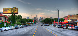
- South Congress (abbreviated SoCo) is a neighborhood located on South Congress Avenue in Austin, Texas, United States. It is also a nationally known shopping and cultural district famous for its many eclectic small retailers, restaurants, music and art venues and, more recently, food trucks.[1]
South Congress begins at the Colorado River and Ann W. Richards Congress Avenue Bridge and runs due south towards Ben White Boulevard/TX-71. The area bordered by two historic South Austin neighborhoods: Travis Heights to the east and Bouldin Creek to the west.
Since its humble beginnings in the 1850s, South Congress Avenue has been transformed from a rural country road to the capital city gateway and, finally, to the vibrant shopping district that it is today. Many Austinites attribute its enduring popularity to the magnificent and unobstructed view of the Texas State Capitol.
- South Lamar*Spyglass-Barton's Bluffs
- South River City
- Travis Heights is a historic neighborhood in south Austin, Texas, United States, bounded by Lady Bird Lake on the north, Interstate 35 on the east, Congress Avenue on the west and Oltorf Street on the south. These boundaries include Fairview Parkan earlier suburb associated with the same developers, running from the west side of Blunn Creek to South Congress Avenue. Part of Travis Heights was stranded east of Interstate 35; many of the same streets to be found west of the highway continue east of it.
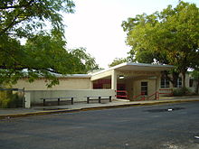
- Zilker a neighborhood in south central Austin, Texas. It extends south of Lady Bird Lake, approximately bounded by the Union Pacific Railway to the southeast/south (Lamar Boulevard south of Oltorf), Barton Skyway to the south, Rabb Road and Azie Morton Road to the west and Lady Bird Lake to the north.
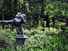
Directly northwest of Zilker is Barton Hills neighborhood, which connects back to Zilker Park via the Barton Creek Greenbelt.
Southeast Central/Riverside
Southeastern Austin between the Colorado River and Ben White Boulevard is generally called the Riverside area.
- East Riverside-Oltorf is a neighborhood in Austin, Texas, located southeast of the city's urban core. The East Riverside, Parker Lane, and Pleasant Valley neighborhoods together form the East Riverside-Oltorf Combined Neighborhood Planning Area. The region is bounded on the north by Lake Lady Bird, to the east by Grove Boulevard and the Montopolis neighborhood, Texas State Highway 71 to the south, and Interstate 35 and South River City to the west.
- Montopolis is a neighborhood in Austin, Texas. Located southeast of the city's urban core, Montopolis encompasses part of ZIP code 78741.
Montopolis is located southeast of Lake Lady Bird and is bounded on the west by Grove Street and the Pleasant Valley neighborhood, to the south by Texas State Highway 71 and the Southeast Austin neighborhood and U.S. Route 183 to the east. It is located adjacent to Austin-Bergstrom International Airport.and is located in city council District 3
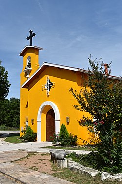
- Pleasant Valley
Southeast
Neighborhoods east of Menchaca Road and south of Ben White Boulevard.
- Dove Springs nicknamed the "44" after the area zip codes, is a neighborhood in Austin, Texas.
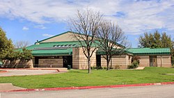
Sam Ramos of the Austin Chronicle stated that the unofficial boundaries of Dove Springs are William Cannon, Ben White, an area east of Dove Springs District Park, and Interstate 35.It is 6 miles (9.7 km) from Downtown Austin.
- Onion Creek is a neighborhood in Austin.Onion Creek is also the name of a creek that starts in Hays County, Texas and empties into the Colorado River (Texas).
- South Manchaca
- Southeast Austin
- Southpark Meadows
Southwest
Neighborhoods west of Menchaca Road and south of Ben White Boulevard and Capital of Texas Highway.
- Cherry Creek
- Circle C Ranch
Circle C Ranch (also known as Circle C) is a large master-planned community in southwest Austin, Texas, USA. Development of Circle C Ranch began in 1982, with the first homes in the community in built in 1986. During development, the subdivision was featured prominently in a long and contentious environmental legal battle regarding urban development in the vicinity of Barton Springs and over Edwards Aquifer. The controversy surrounding its development and later annexation by the city of Austin was a landmark in municipal annexation rights in Texas.

The area now known as Oak Hill was initially known as Live Oak Springs in the 19th century. The land was awarded to William Cannon by the Mexican government in 1835, attracting settlers into the area.In 1865, unsuccessful attempts were made to change the community's name to Shilohafter the American Civil War battle.In 1869, however, the community was given the name Oatmanville. Following the Civil War, the cedar forests around Oatmanville attracted settlers, particularly from the Appalachian Mountains, due to high demand for lumber-related production. Due to the increased demand for cedar, localized conflicts broke out between woodcutters. In 1870, a post office named Oak Hill was establishedthough the community would not immediately adopt that name
- Far South Austin/Slaughter-Manchaca
- Kincheonville
- The Ridge at Lantana
- Maple Run
- Sendera
- Shady Hollow
- Sunset Valley is a city in Travis County, Texas, United States. The population was 749 at the 2010 census. It is surrounded on all sides by the city of Austin, therefore being an enclave.
- Tanglewood Forest
- Travis Country
- Westgate is a neighborhood in Austin, Texas, located southwest of the city's urban core. It includes ZIP code 78745.
Westgate's boundaries are Ben White Boulevard and the South Lamar and Barton Hills neighborhood to the north, Manchaca Road and the South Manchaca neighborhood on the east, Stassney Lane and the Garrison Park on the south and Westgate Boulevard and the city of Sunset Valley the west.
From the period from the mid-1950s to the late 1960s, Westgate's development was largely residential and the area contains many single-family homes. However, by the late 1990s the Westgate Shopping Center at the intersection of Ben White Boulevard, Lamar Boulevard, and the Capital of Texas Highway was built.
- Woodstone Village
Learn more about Austin TX Learn more about our services
If you are moving to Austin and need more information on a mold inspection service learn more here.
Contact Us
Recon Mold Remediation Solutions
Austin, TX
A+ Rated
24/7 Emergency service
Immediate Response
5 Star Reviews
Locally Owned and Operated
We bill directly to insurance
We Offer Environmental Consultant Services Austin:
- Mold Inspection
- Mold Inspection
- Mold Remediation
- Mold Removal
- Asbestos
- Asbestos Abatement
